Our geographers have discovered the remains of landscapes thought to have formed when ancient rivers flowed across East Antarctica.
These flat surfaces, buried beneath a 3,500km stretch of the East Antarctic coastline, could help predictions of future loss from the ice sheet.
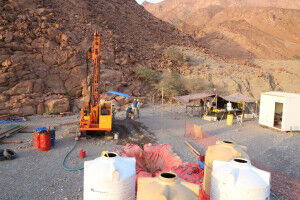
Radar measurements
An international team led by Durham University examined radar measurements of ice thickness to reveal the previously unmapped landscapes.
These surfaces were once connected and it’s believed were formed by large rivers after East Antarctica and Australia broke apart approximately 80 million years ago, and before ice covered Antarctica about 34 million years ago.
Barriers to ice flow
The surfaces are now hidden beneath the ice sheet and separated by deep troughs, which fast-flowing glaciers are steered through. The ice above the surfaces is moving much more slowly.
Ice loss from Antarctica is increasing, but the flat surfaces act as barriers to ice flow and may currently be regulating the rate of ice loss.
Impact on global sea levels
East Antarctica has the potential to raise global sea levels by 52 metres if it were to melt completely.
Adding the newly discovered surfaces’ effects into models of future ice-sheet behaviour could help refine projections of how the East Antarctic Ice Sheet might react to climate change and what its impact on global sea levels could be.
More about research lead author Dr Guy Paxman , a Royal Society University Research Fellow in our Department of Geography.
Our Department of Geography is ranked 11th in the QS World University Rankings by Subject 2025. Geography webpages
The research was funded by the Natural Environment Research Council , a Leverhulme Trust Early Career Fellowship, the European Research Council , the AWI INSPIRES III programme and the Natural Science Foundation of China.
The Palatine Centre
Durham University
Stockton Road
Durham
DH1 3LE