 Satellite imagery - A glimpse of the variety of satellite imagery covered by the WorldStrat dataset.
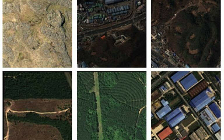
Satellite imagery - A glimpse of the variety of satellite imagery covered by the WorldStrat dataset. Credit: © Airbus SPOT 2021 - A global open-source dataset of high-resolution images of Earth - the most extensive and detailed of its kind - has been developed by experts led by UCL with data from the European Space Agency (ESA). The free dataset, WorldStrat, will be presented at the NeurIPS 2022 conference in New Orleans. It includes nearly 10,000km² of free satellite images, showing every type of location, urban area and land use from agriculture, grasslands and forests to cities of every size and polar ice caps. The dataset includes locations in the Global South and those needing humanitarian aid, which are often underrepresented in satellite imagery because this is usually collected for commercial gain, therefore disproportionately featuring wealthier regions. The scientists say the collection enables worldwide analysis of terrain to tackle global challenges such as responding to natural and man-made disasters, managing natural resources and urban planning. Work on WorldStrat began in 2021, and since it launched in June 2022 it has been downloaded over 3,000 times.
TO READ THIS ARTICLE, CREATE YOUR ACCOUNT
And extend your reading, free of charge and with no commitment.
Your Benefits
- Access to all content
- Receive newsmails for news and jobs
- Post ads